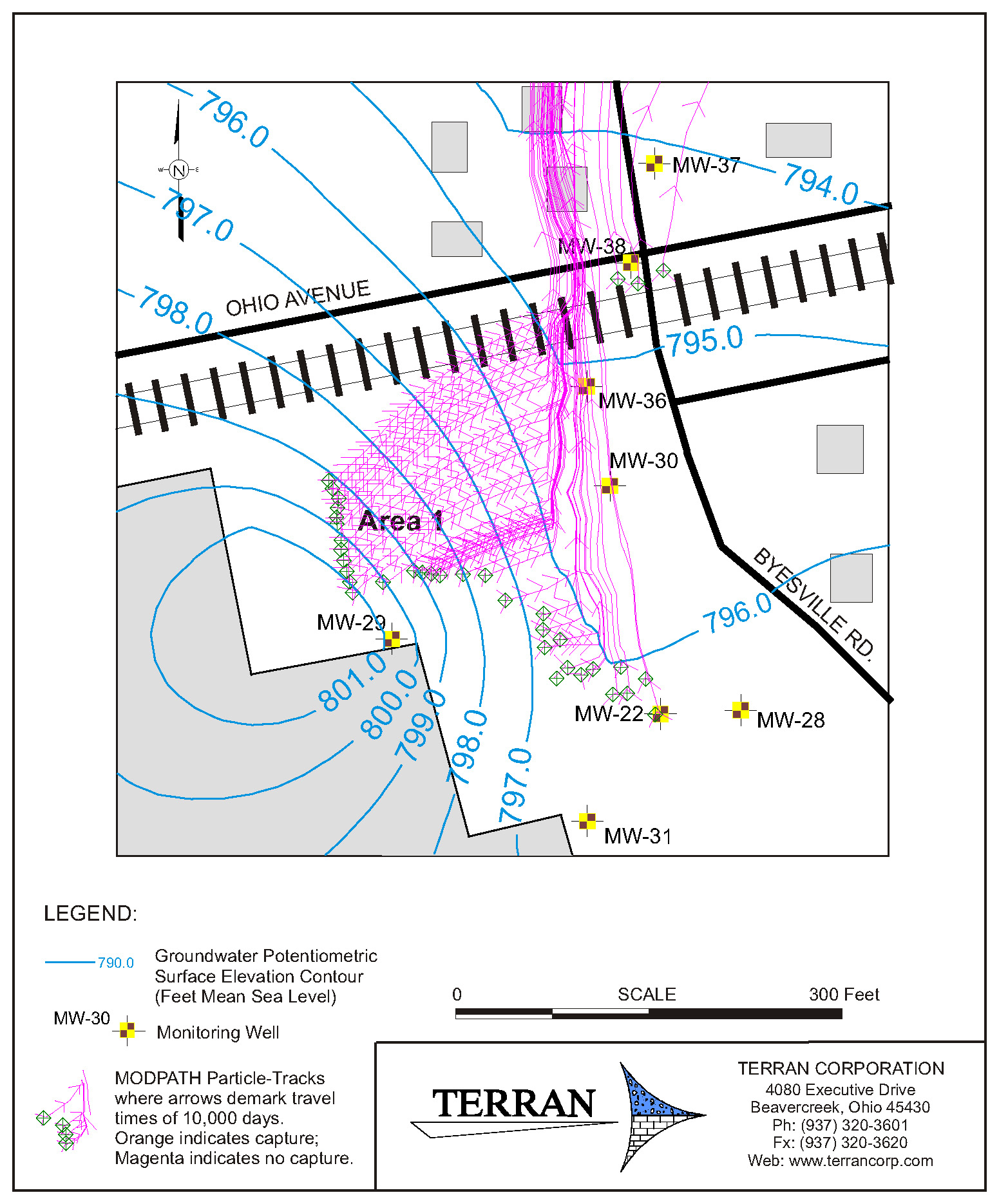
Phytoremediation, the use of certain types of plants to aid in the treatment of certain chemical contaminants, was evaluated at a manufacturing site in Cambridge, Ohio. The site subsurface soils and groundwater was impacted by volatile organic compounds. This site was underlain by a thick glacial lacustrine (lake) deposit consisting of massive to laminated and varved clays that where 110 feet deep in places. Fine sand deposits occur as remnant beachfront along a sandstone bedrock formation on the east side of the site. The thick lacustrine deposit is not considered a water-bearing deposit or aquifer from the standpoint of water-development purposes, but the deposit will yield groundwater to site monitoring wells and produces a potentiometric surface map from which groundwater flow patterns can be discerned.
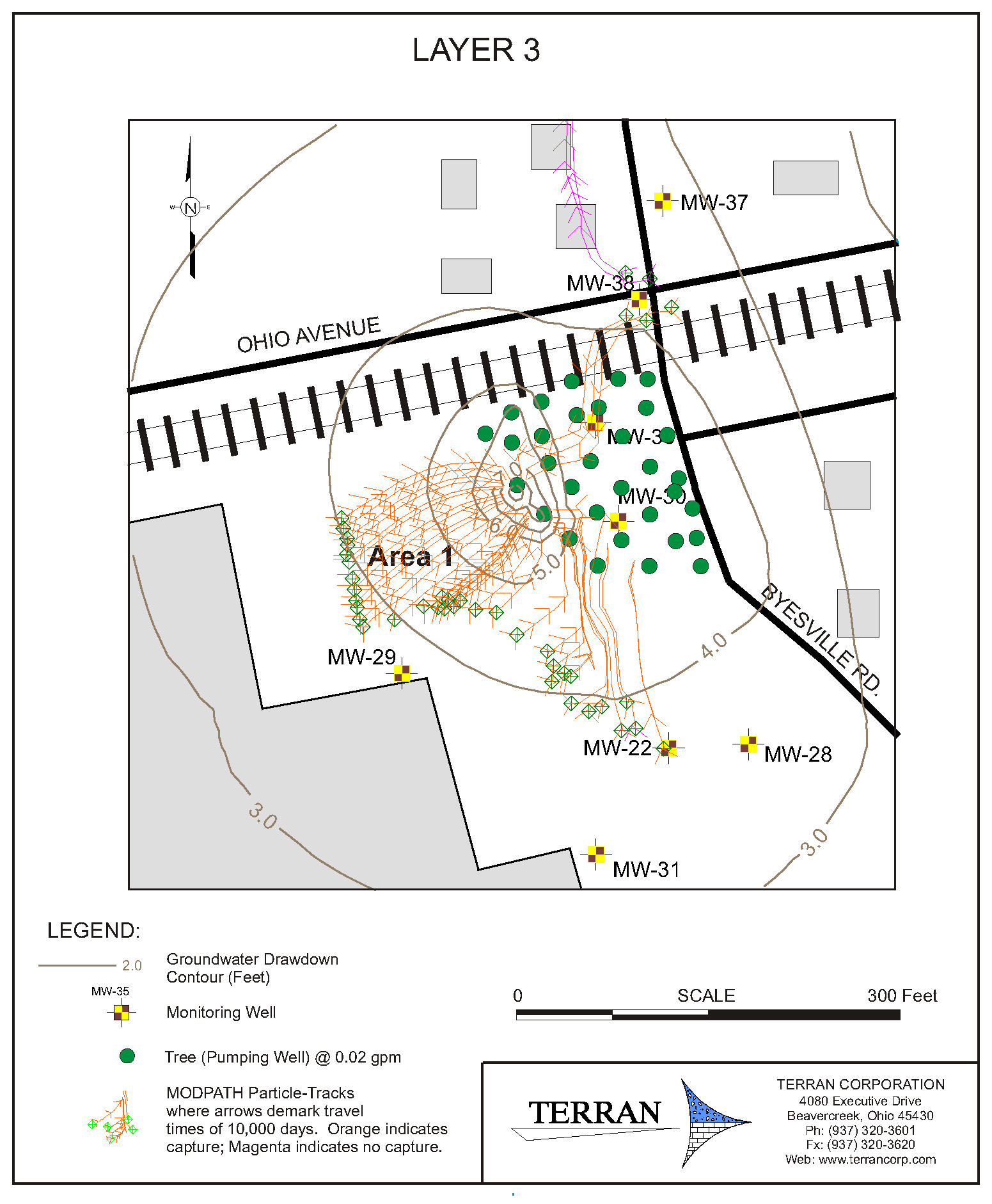
The clayey soil precluded the use of many standard types of remediation due to the high clay-silt content. One remedial method, phytoremediation, was evaluated as a method to control the slow moving VOC contamination. Phytoremediation controls contaminant migration through the use of hybrid poplar trees to work as natural “pumps” to control and remediate groundwater. To assist in the design of the phytoremediation system, a groundwater computer model was constructed using MODFLOW to simulate the hydrogeologic system of the site. In this case, the model was used to simulate the movement of groundwater through the fine-grained clay deposits of the site. The model was calibrated to site ground water data and the hybrid poplars were simulated a miniature pumps, each removing 0.02 gallons/minute/tree to represent the summer month activity when evapotranspiration is highest.
The Ohio EPA and client decided to pursue a combination of LASAGNA soil treatment and slurry clay wall to treat site soil VOCs and control off-site migration (instead of using phytoremediation). Given the unusual nature of using MODFLOW to simulate a clay-dominated site such as this one, we decided to include it in our project descriptions.

Calibrated site MODFLOW groundwater flow map.

MODFLOW map with phytoremediation scenario.
More examples of Terran Corporation’s modeling projects:
- Arsenic and Chloride Fate and Transport Modeling for Water Supply Permitting.
- Assessment of Aquifer Sustained Yield Potential.
- Hydrogeologic Evaluation for Wellfield Development.
- Aquifer Evaluation and Ground Water Modeling for a New Water Supply.
- Well Head Protection Area Study.
- Substructure Flooding Potential.
- Construction Dewatering Study.
